Navigating through large buildings, university or office campuses, shopping malls, and even cinema halls can be a daunting task! But with the right approach (read tools), it becomes a seamless experience. In this blog, I will take you through the key considerations in building a digital wayfinding map, its benefits beyond guiding directions, and some easy ways to design one.

What is a Wayfinding Map?
Wayfinding maps are tools designed to help individuals navigate large buildings, campuses, and shopping malls. These aid visual representations of the environment, highlighting key landmarks, routes, and facilities.
A digital wayfinding map addresses the challenges of navigating spaces, ensuring visitors can effortlessly find their desired destinations and access necessary amenities. Let’s consider a large technology park with multiple buildings and offices. Within this complex environment, wayfinding maps prove invaluable in helping visitors navigate the grounds. These electronic signs, strategically positioned throughout the park, guide individuals to specific buildings, conference rooms, cafes, and other locations.
How to Design a User-Friendly Wayfinding Map?
Here are seven ways digital signage solutions contribute to creating user-friendly wayfinding maps:
1. Understanding User Needs
Digital signage solutions are crucial in creating user-friendly wayfinding maps and understanding the target users and their demographics.
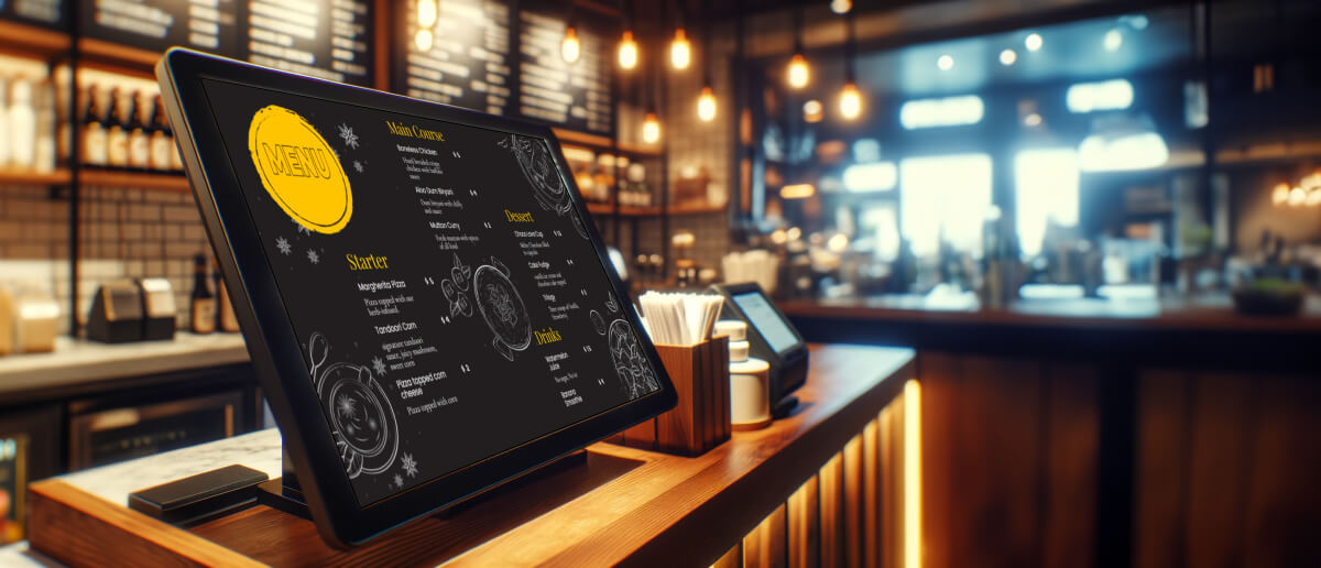
For example, digital wayfinding maps in airports can alleviate navigation challenges by displaying clear directions, essential information, and real-time updates on strategically placed digital screens. These guide passengers to gates, baggage claim areas, check-in counters, and other facilities while providing flight schedules and boarding information. Addressing specific needs and preferences for different venues is vital in creating a user-friendly wayfinding map.
2. Leveraging Digital Technologies

Signage technology considers some crucial aspects when simplifying information on wayfinding maps for complex architectures. Interactive touchscreens, mobile applications, and QR codes
facilitate user engagement and provide seamless access to relevant information. Interactive wayfinding maps allow users to engage directly with the outline on-screen enabling them to search for specific locations, view detailed information, and obtain personalized directions.
On the other hand, mobile applications complement this experience by extending the functionality to users’ devices, allowing them to access maps, receive real-time updates, and navigate.
A 3D digital wayfinding map can augment static maps with interactive elements, highlight points of interest, or integrate additional layers of information. This provides users with a comprehensive and rich experience, enabling them to navigate spaces more effectively.
Also read: Top biggest malls in the world that use wayfinding maps to ease customer accessabillity
3. Prioritizing Accessibility
Signage accessibility is a crucial aspect to consider when designing a user-friendly wayfinding map. Visual accessibility is a thoughtful design choice addressed in a wayfinding map. For example, high-contrast colors enhance visibility and legibility.
Additionally, using large fonts with a minimum size of 18 points makes it easier for users to read directions, labels, and other important information. For individuals with visual impairments, haptic touch can be a wayfinding aid by providing tactile cues or feedback when interacting with touchscreens or digital maps.
4. Simplifying information for clarity

In complex architectures, it is essential to simplify the information on wayfinding maps to ensure clarity for users. A university campus, for example, can use clear labels, symbols, and color coding to enhance map readability.
Labels concisely describe locations and facilities, symbols represent amenities like restrooms and elevators, and color coding differentiates areas or categories. Additionally, distinct colors can denote different departments or floors within a building. These techniques make the wayfinding map more user-friendly, helping individuals navigate the campus effectively.
Check out: Top largest railway station in india which uses wayfinding maps for ease passenger navigation
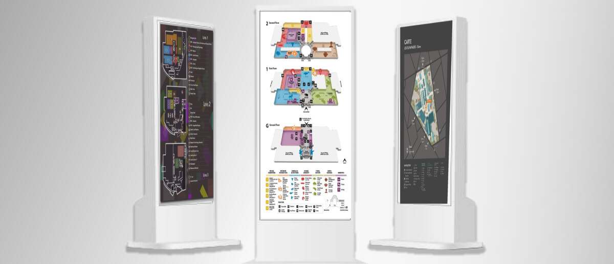
5. Providing Multiple Perspectives
Well-designed wayfinding maps improve the overall user experience and reduce navigation challenges in complex architectures. Overview maps provide a comprehensive view of the entire layout, allowing users to understand the overall structure and the relationships between different areas. These help newcomers who need a broad understanding of the venue, such as a large campus or a sprawling shopping complex.
Detailed maps focus on specific areas or sections within a larger venue. For example, a detailed wayfinding map in a theme park highlights attractions, dining options, and restrooms within each themed area. Frequent visitors can efficiently navigate specific areas using these maps, saving time and enjoying their preferred experiences.
6. Incorporating Clear Path Markers
Digital wayfinding maps employ a series of digital markers to guide users effectively in real-time. Digital displays are crucial in enhancing the navigation experience by providing real-time information. These displays can dynamically update to show relevant directions, announcements, and alerts.
For instance, digital screens in a shopping mall can showcase ongoing sales, promotions, and special events alongside a wayfinding map that directs them to specific stores or sections within the mall. Path markers align with the information presented on the wayfinding maps, ensuring consistency.
This synchronization ensures that physical and digital markers reinforce the directions and information, reducing confusion and enabling users to follow the designated routes.
7. Testing and Iteration
Testing and iteration are crucial in developing user-friendly wayfinding maps. Through usability tests, user interactions observed identify areas of confusion or difficulty. For example, digital signage analytics can help understand how users navigate a museum using wayfinding maps that reveal if directions or labels are unclear. The wayfinding map design can be iterated based on the insights gained from testing and feedback. This involves making adjustments and enhancements to improve usability and address identified issues.
Benefits of Digital Wayfinding Maps
By implementing these maps through on-premise digital signage , organizations maintain full control over content, ensure data privacy, and handle layout or building plan updates internally without relying on external advertising networks or third-party systems.
If you think that a wayfinding map is limited to only directions, these 5 benefits will make you go beyond! Read on!
Enhanced Branding across displays: Digital wayfinding maps provide a great platform to strengthen brand perceptions. By integrating the organization’s logo, colors, and visual elements into the map design, each user interaction reinforces the brand image. For example, a museum featuring its unique logo and color scheme on digital wayfinding screens elevates the overall brand perception and leaves a lasting impression on visitors.
Emergency updates: Digital wayfinding tools serve as a centralized communication platform, enabling swift dissemination of emergency messages throughout a location. For instance, in case of a fire, hospital wayfinding maps can guide patients and staff to the nearest emergency exists, show directions to fire extinguishers and stairways meant for evacuation.
Time and Cost Savings: Time and Cost Savings: Digital wayfinding maps enable efficient updates, saving both time and money. A cloud-based content management system ensures real-life updates without reprinting static maps. For instance, a university can easily update classroom locations or building closures on digital wayfinding screens without incurring additional printing expenses.
Revenue Generator: Digital wayfinding maps offer opportunities for revenue generation. Organizations can leverage the platform to showcase advertisements or promotions from relevant businesses or sponsors. For instance, a shopping mall can display the retail stores it houses, restaurants, or upcoming events on the digital wayfinding map alongside directions to each.
Reduced inconsistencies: Digital wayfinding maps enable easy and affordable updates, ensuring content relevance. For example, a conference center can quickly modify room assignments or session times on the wayfinding map, eliminating inconsistencies and providing attendees with the most accurate and relevant information throughout the event.
Immersive Experience: Digital wayfindings can majorly improve the fan experience in sports stadiums. For instance, sports stadium wayfinding powered by digital signage software can display real-time information about shorter queue times, direct fans to specific merchandise offers, or even provide interactive games or entertainment during breaks in the game. This not only helps fans navigate but also keeps them engaged, contributing to a more positive fan experience within the stadium.
Also read: Impactfuldigital wayfinding benefits across various industries
Where Does a Wayfinding Map Find Proper Utilization?

Wayfinding maps find effective utilization in a variety of locations and contexts. They are valuable for assisting your audience in navigating complex environments efficiently. These maps enhance the overall visitor experience by integrating technology, design principles, and user-friendly features.
A wayfinding map is useful in the following areas:
Digital signage solutions are revolutionizing the design of wayfinding maps, offering numerous benefits to visitors and organizations alike. With an interface that simplifies navigation, these provide clear path markers, personalized directions, and dynamic updates. Whether it’s a bustling airport, a sprawling campus, or a vibrant shopping mall, digital wayfinding maps are transforming how we navigate and engage with our surroundings!